America’s ancient civilizations
The heritage of the Pre-Columbian civilizations of America
In order to understand the present it is essential to understand the past…. Well, it must be true!! However, I have always been fascinated by the Pre-Columbian civilizations of America. Thus, I’ve decided to craft a
According to the Saga of the Greenlanders, in the year 1001 Leif Erikson – the son of the legendary Erik the Red – and his companions set foot on a blessed land. Nevertheless, it was not until 1960 that proof of the existence of a Viking settlement was found at L’Anse aux Meadows, a village at the tip of the Great Northern Peninsula on the island of Newfoundland. However, those first pioneers did not succeed in colonizing the new continent, so, for Europeans, the discovery of America continues to occur on October 12, 1492, when the caravels led by Christopher Columbus reached the coast of San Salvador.
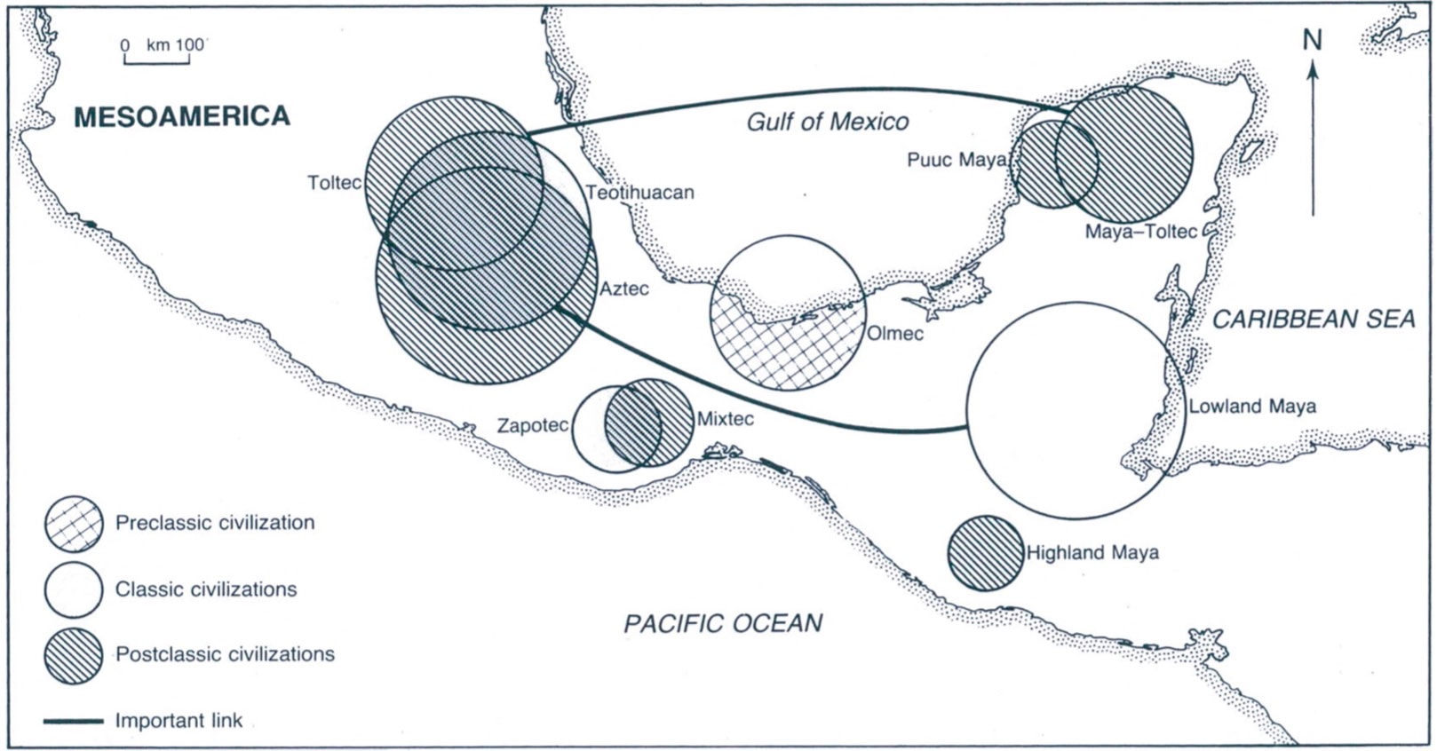
At that time, the major cultures and civilizations in Central America were the Olmec, the Maya, and the #Aztec whereas in South America the Moche, the Wari, the Tiwanaku, the Chimor, and the Inca. In most countries of the Americas, the descendants of such fierce warriors still survive in autonomous (to various extents) communities.
Honduras, Guatemala, and Mexico
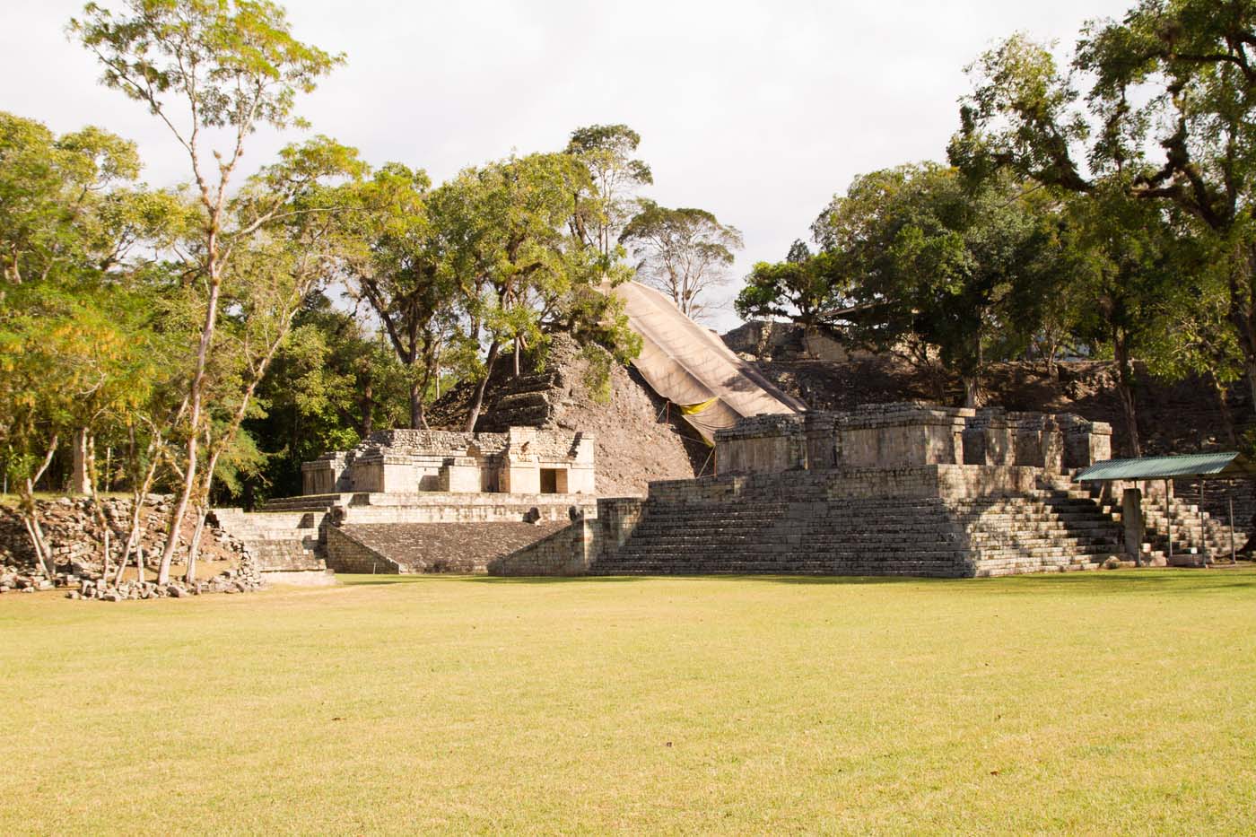
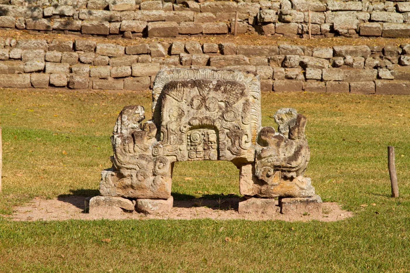
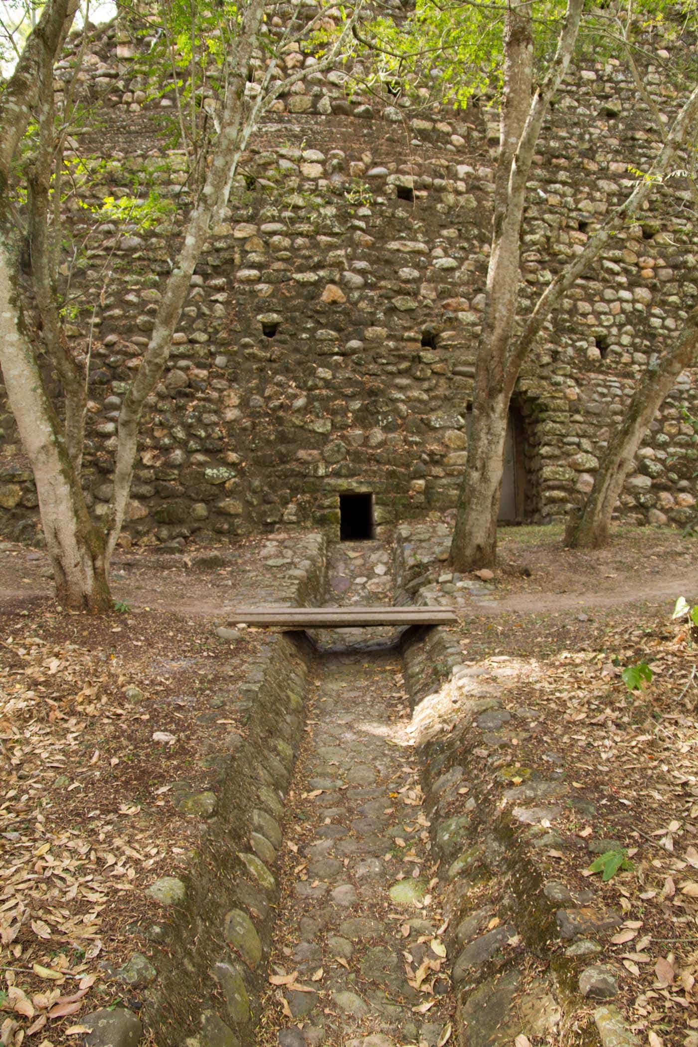
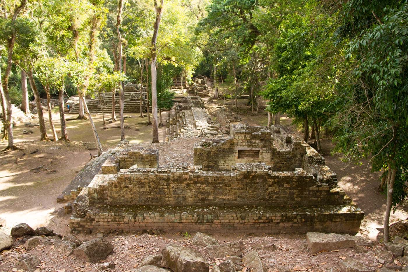
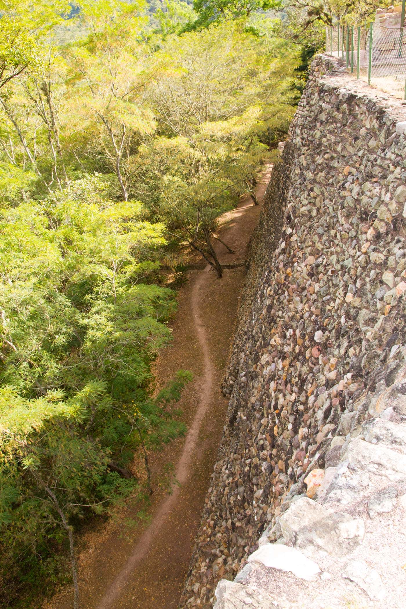
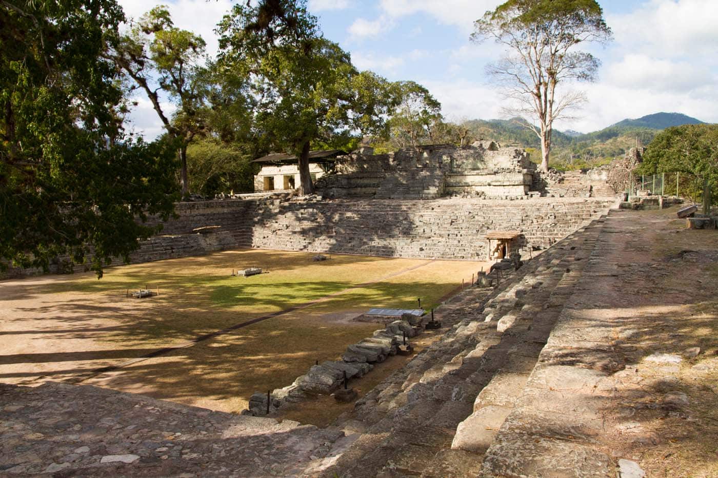
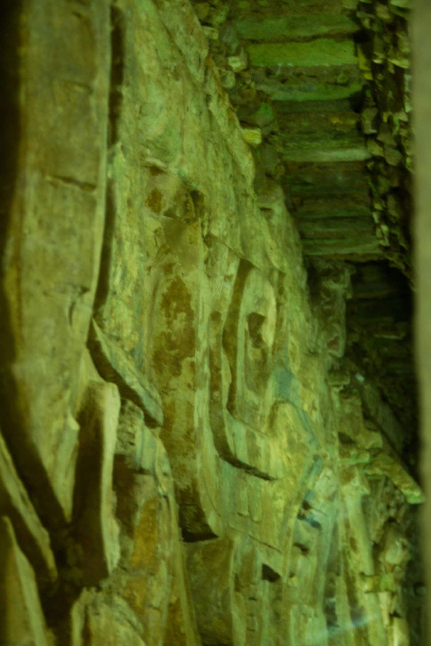
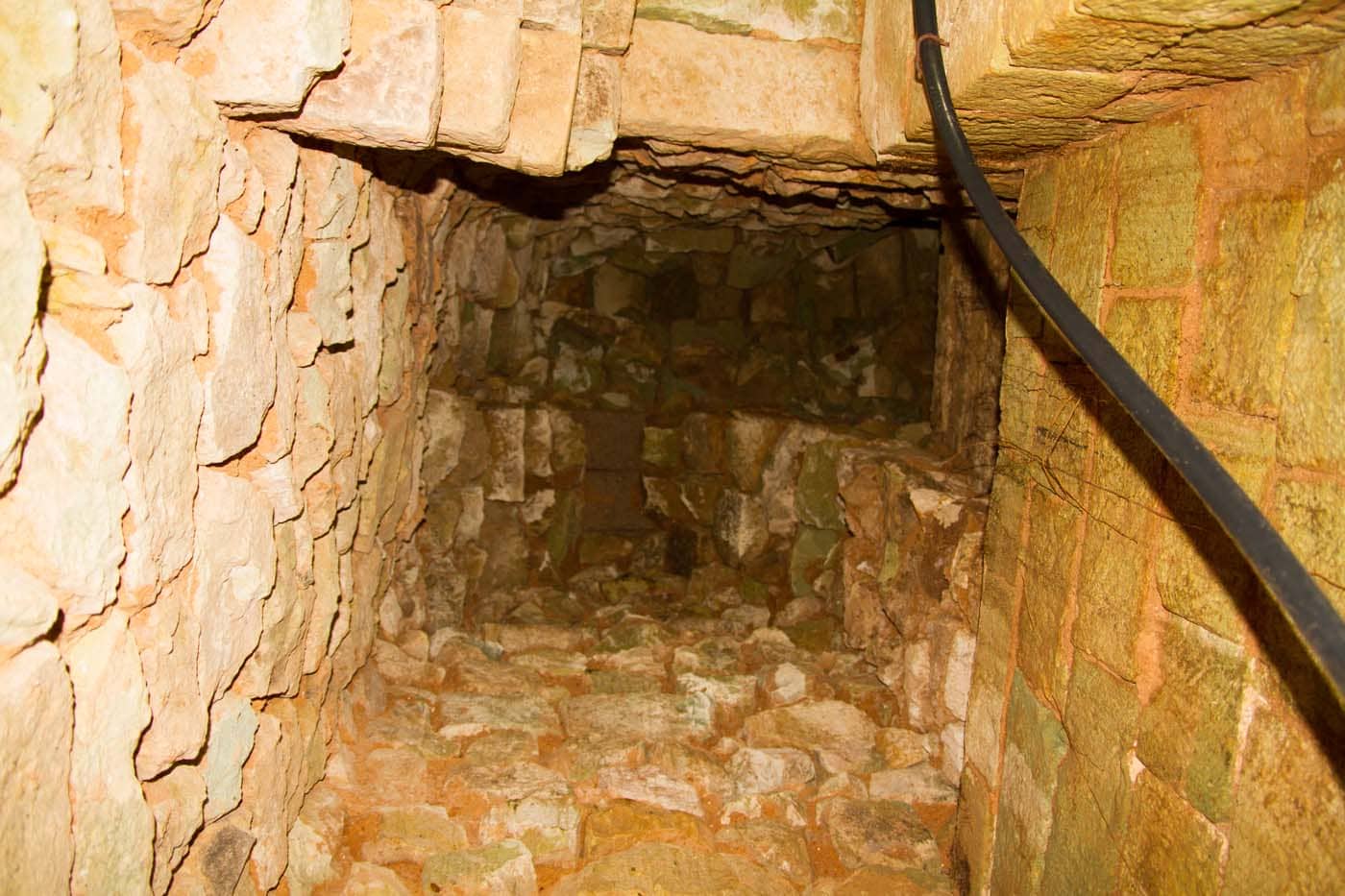
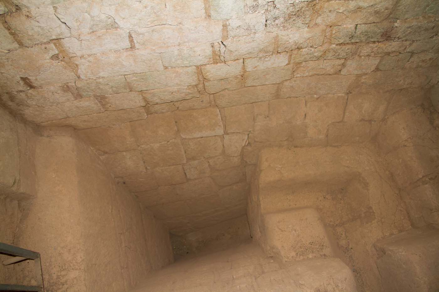
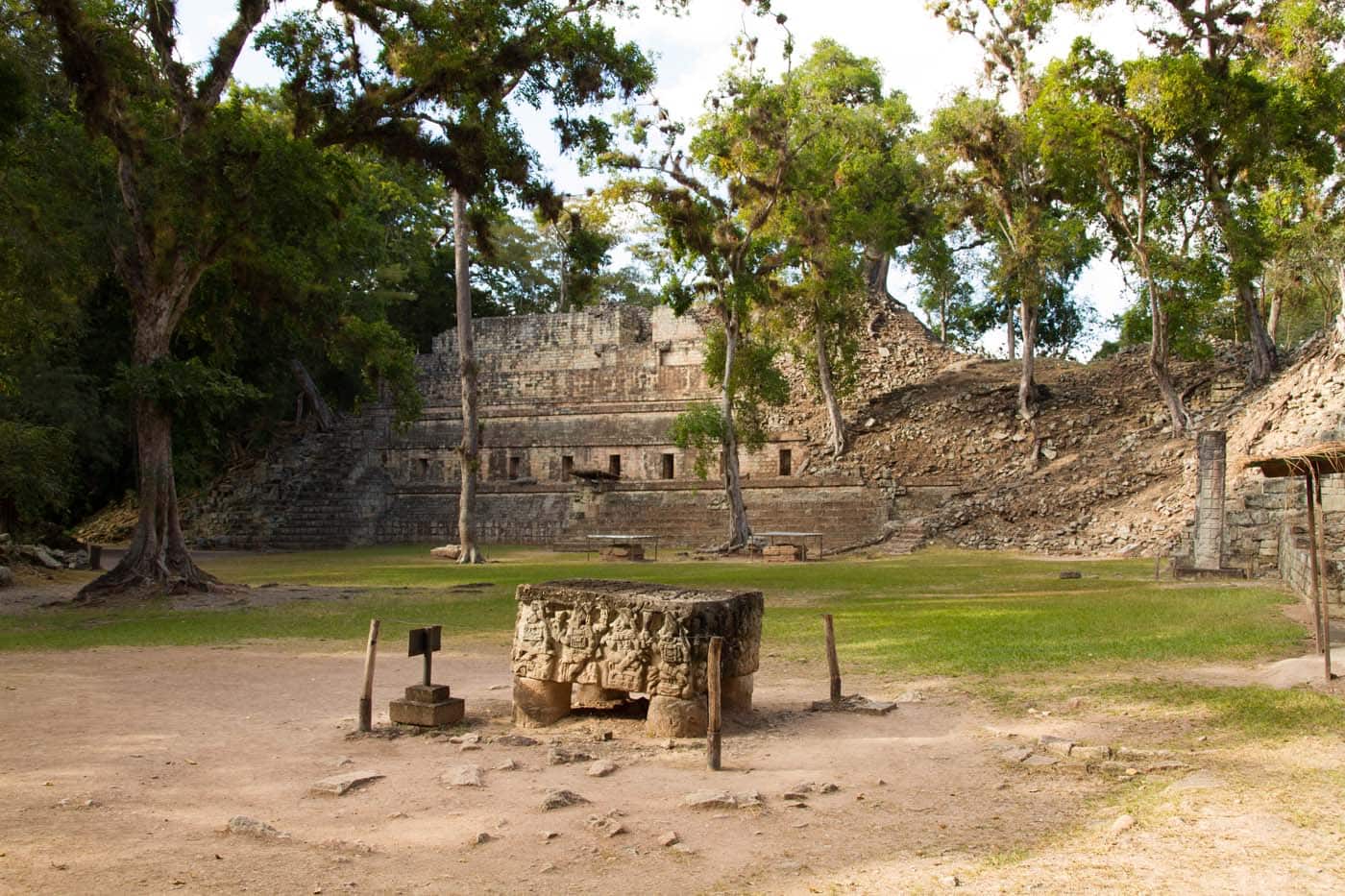
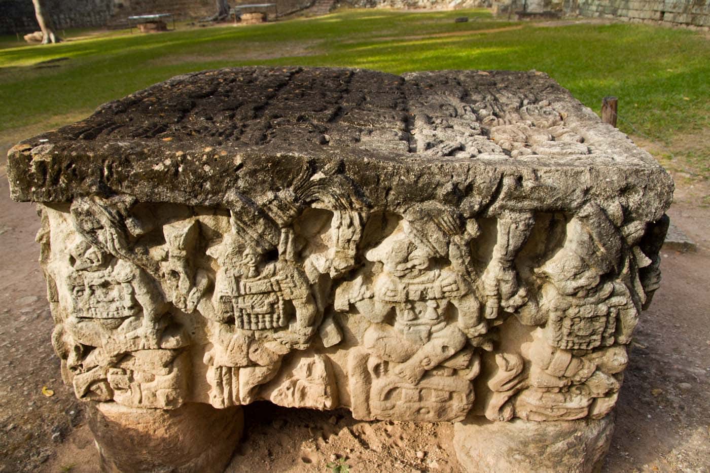
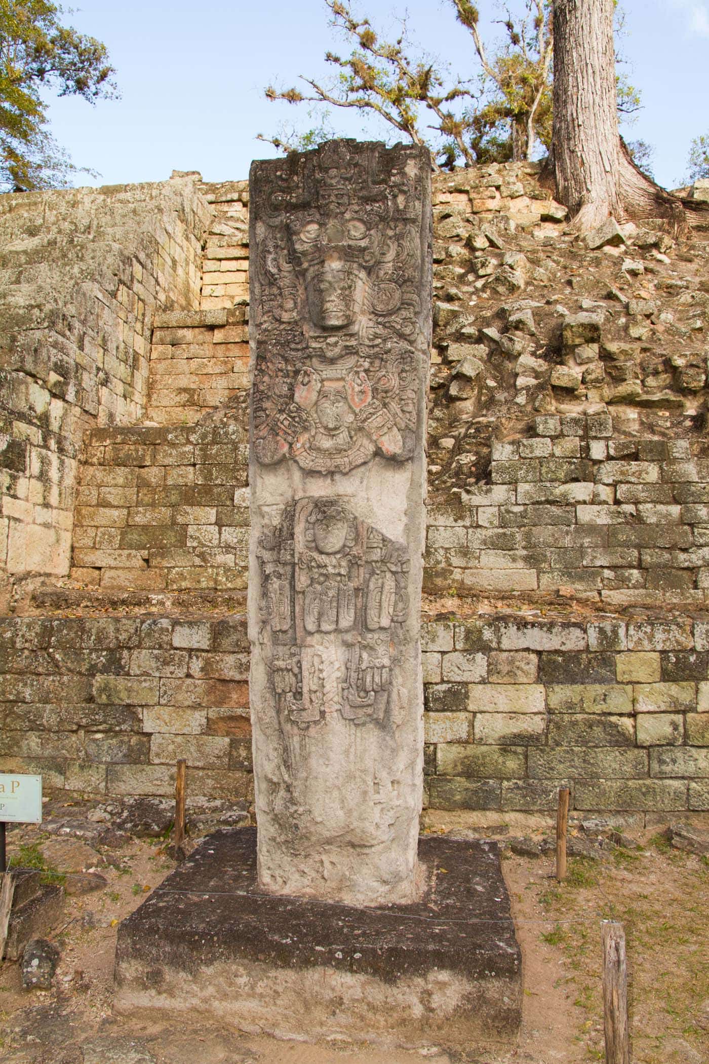
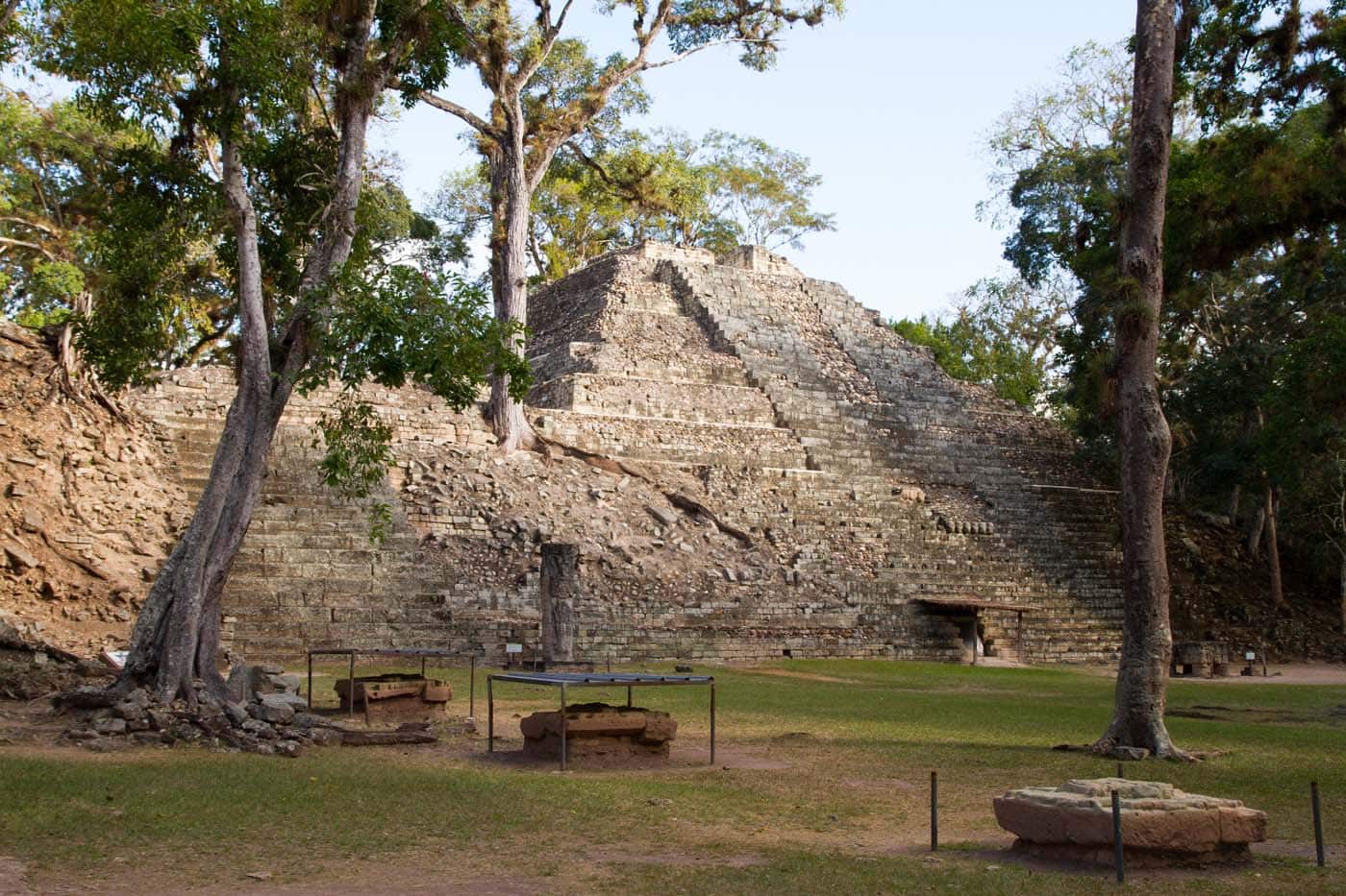
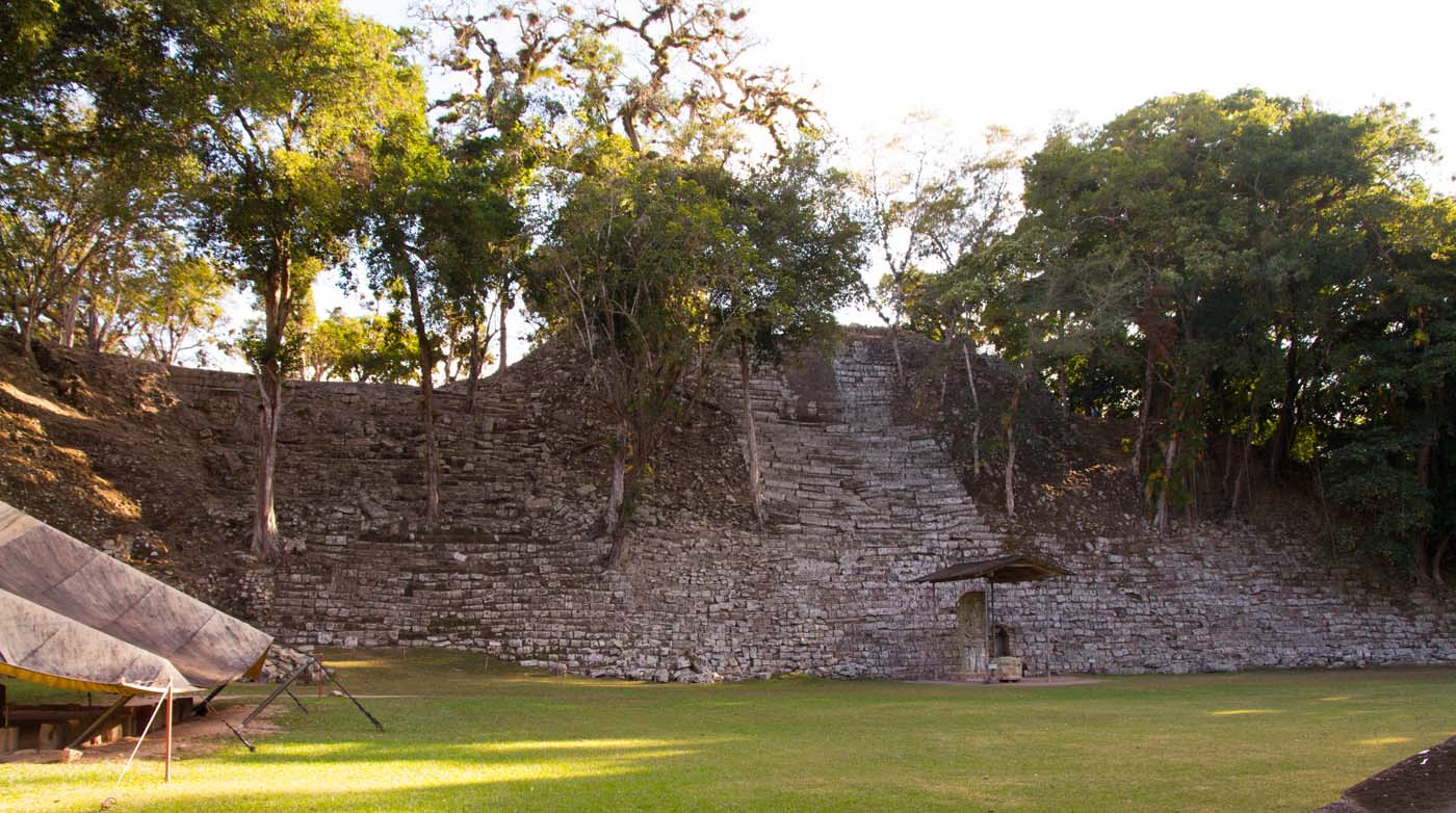
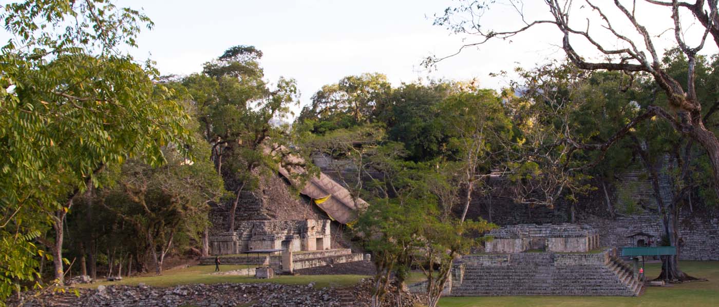
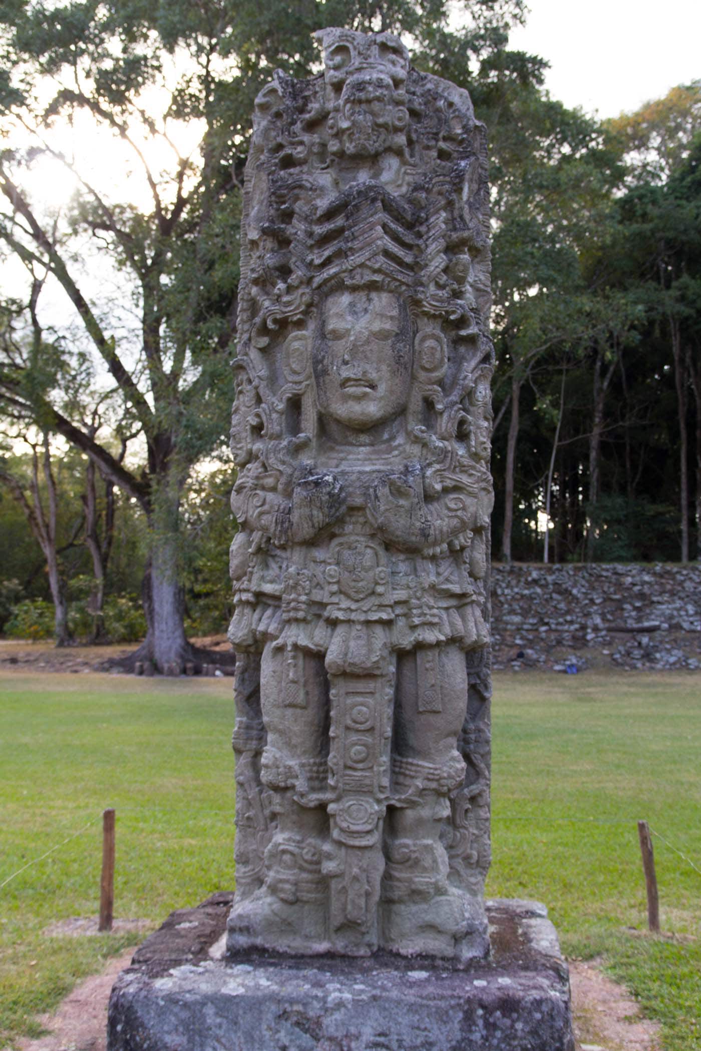
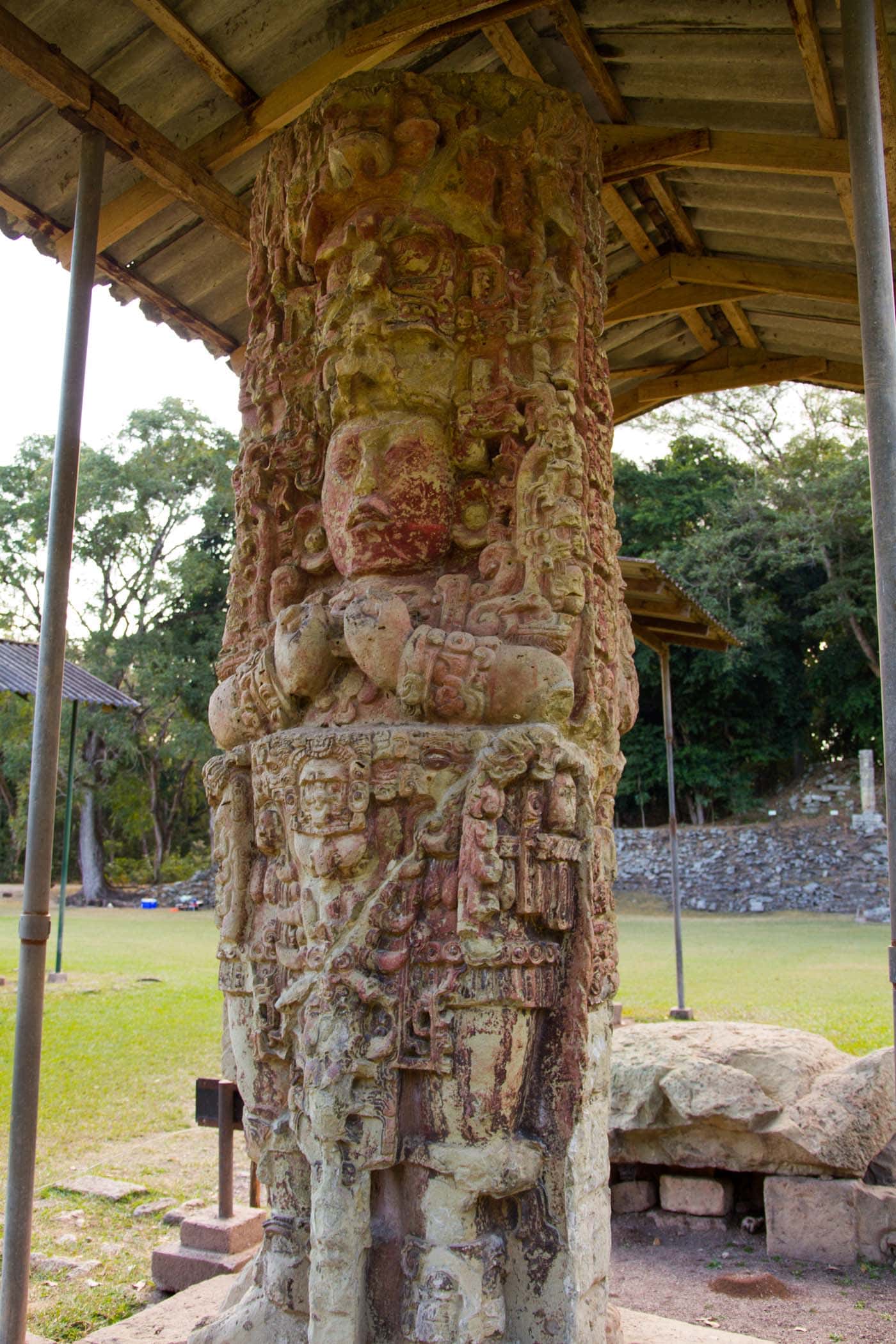
Copán was a major capital city during the Classic period of the Mayan civilizations; indeed, it testifies the magnificence of the Mayan civilization. Easy travel in Honduras simply booking a bus across Panama and Costa Rica. Unlike Tikal, Palenque, and other of the major cities of the huge Mayan Empire, Copan is distinguished more by its huge quantity of art than by its architecture. The number of sculptures and stelae on the site is impressive: 4,509 buildings have been counted, 3,450 of which lie within an area of just nine square miles around the nucleus of the site.
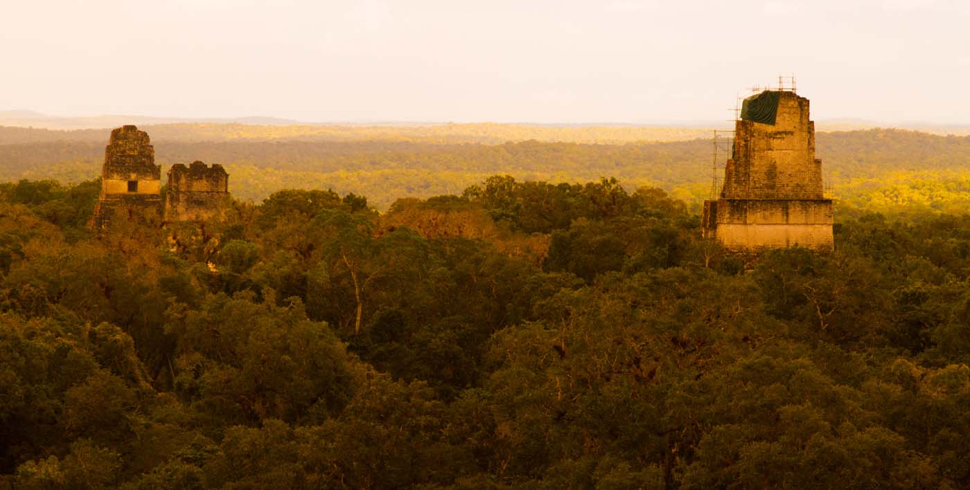
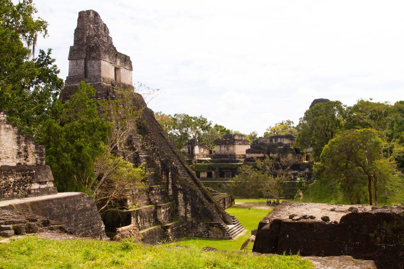
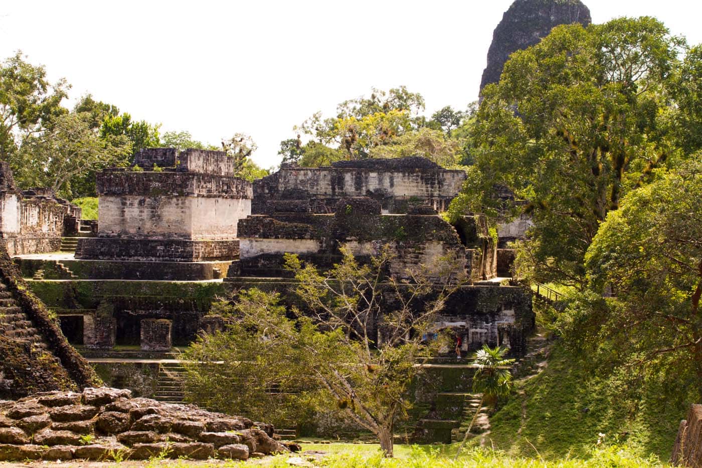
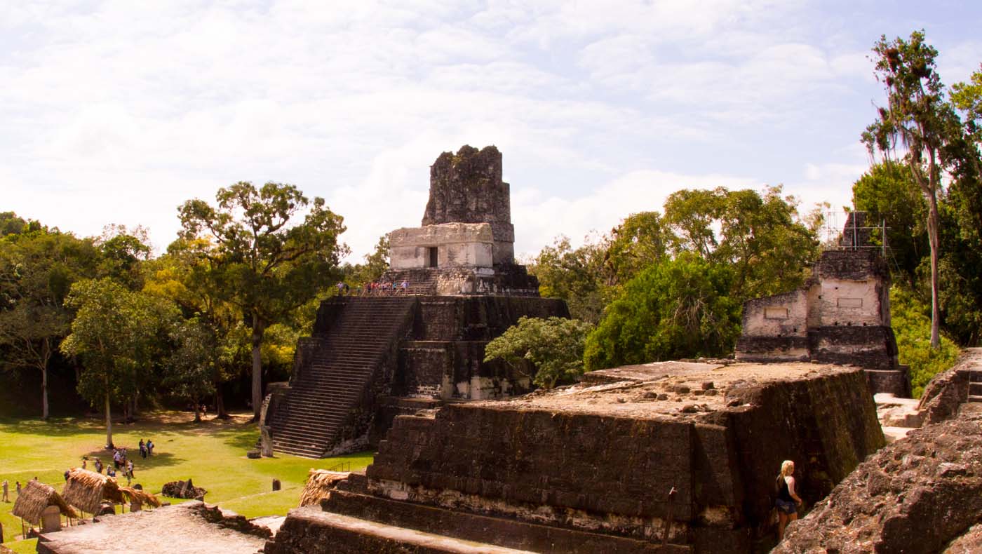
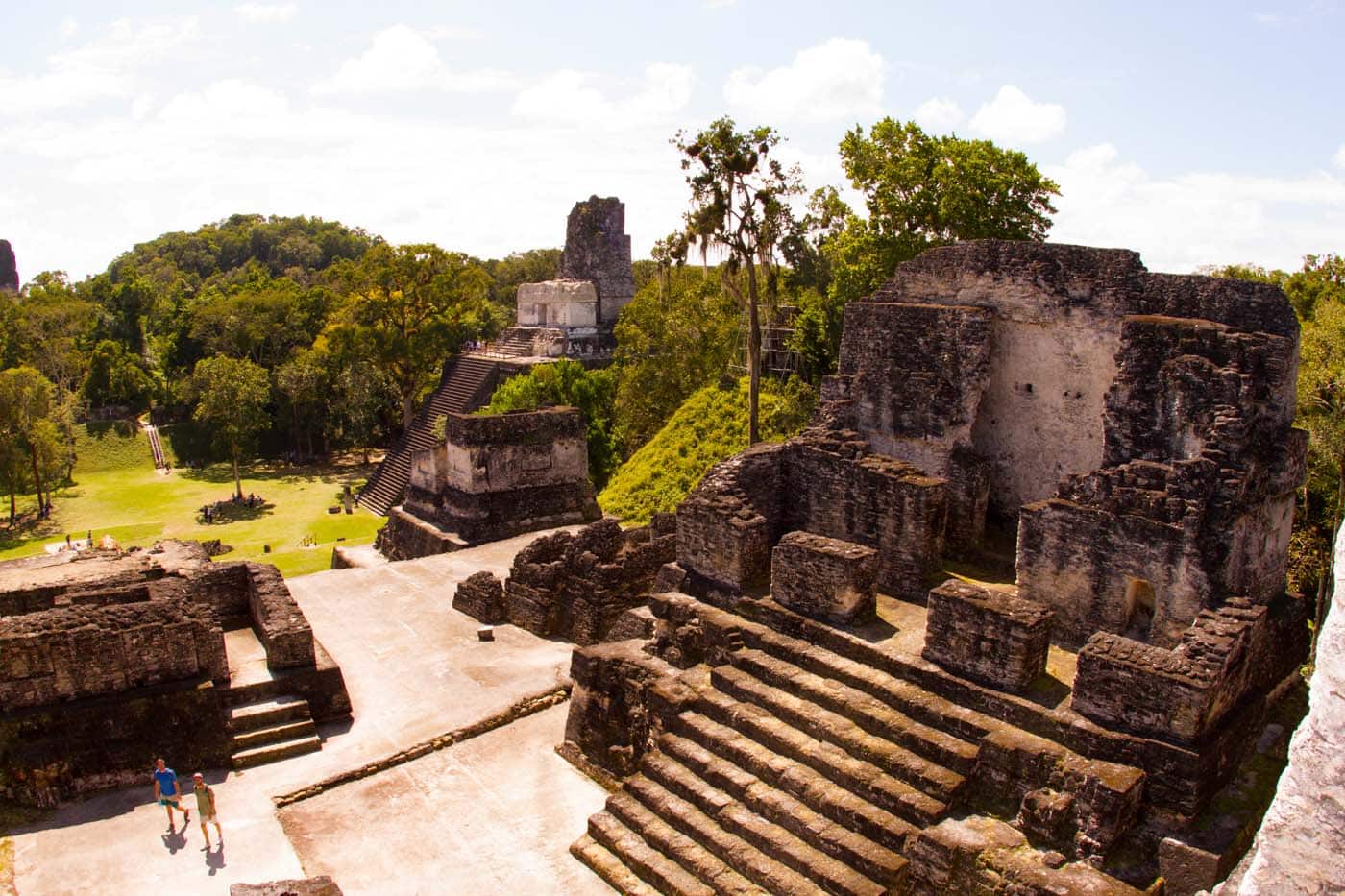
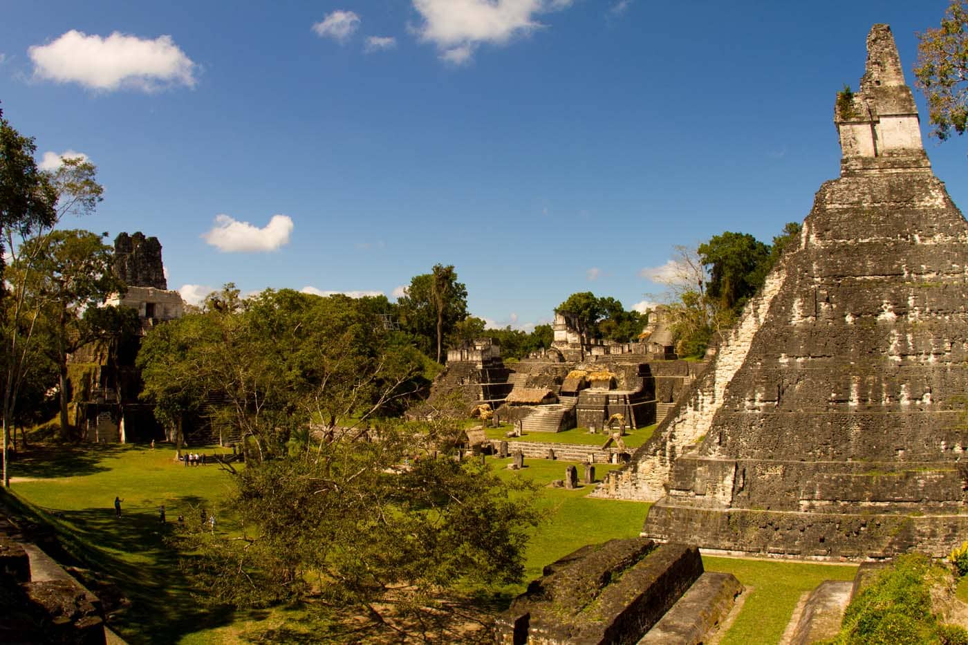
Tikal is situated close to Flores and Santa Elena, it is one of the largest cities with up to 90.000 inhabitants. The city grew economically and politically during the Pre-Classic and up to the Late-Classic period; indeed, Teotihuacan had embassies in Tikal, as well as the founding of the Copán dynasty probably involved the direct intervention of Tikal. Finally, during the hiatus period (at the end of the Late-Classic period), at least one ruler of Tikal took refuge in Palenque. At that time, the many sandstone pyramids of the ancient city (which represent the mountains where corn, a food sacred to the Maya, originated) were covered with stucco painted in dazzling colors featuring scenes of religious rituals or even entirely red. For example, the stelae in the Great Plaza were red, the ones carved with the portraits of 26 of the kings that ruled Tikal. The colors, which have been washed away by centuries of rain, were identical to the plumage of the parrots, toucans, and hummingbirds that today nest in the cracks of the temples.

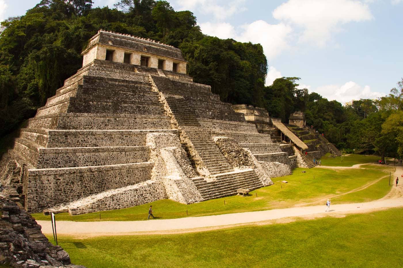
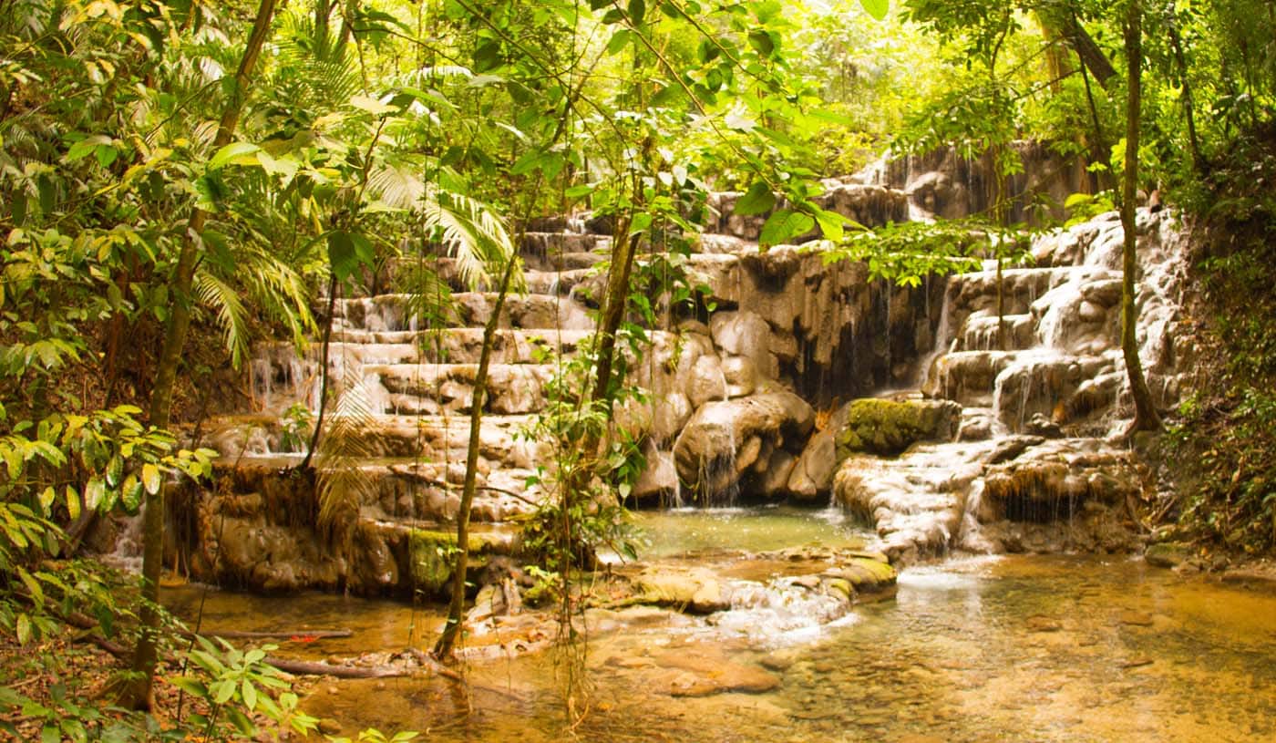
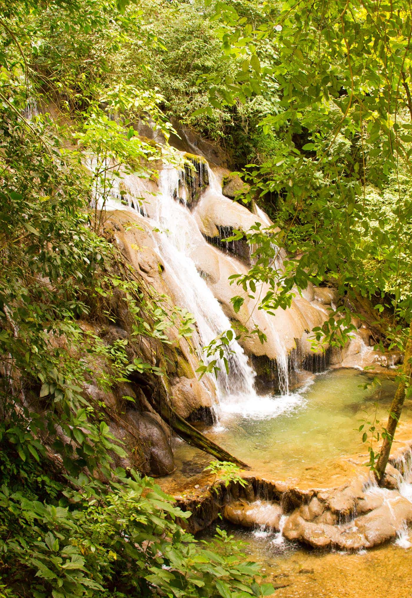
Palenque is a medium-sized site, smaller than Tikal or Copan, but it contains some of the finest architecture, sculpture, and representations produce by the Mayan civilization. Situated in the valley of the Rio Usumacinta, the area with the highest rainfall in all of Mexico, Palenque lies in a dense forest featuring many waterfalls. It was this abundance of water and the fertility of the soil that allowed the city to develop and become rich. In 1952, after four years of digging, Ruz discovered the first pyramidal tomb in the Americas, the eternal abode of Pakal, the legendary ruler of Palenque. Having ascended the throne at the age of 12 and died at almost 80, Pakal was a sort of Charlemagne of Mesoamerica. A man of great political and administrative skills, he encouraged the city’s architectural and artistic development.

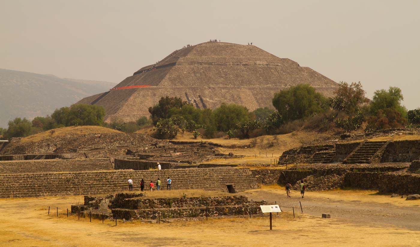
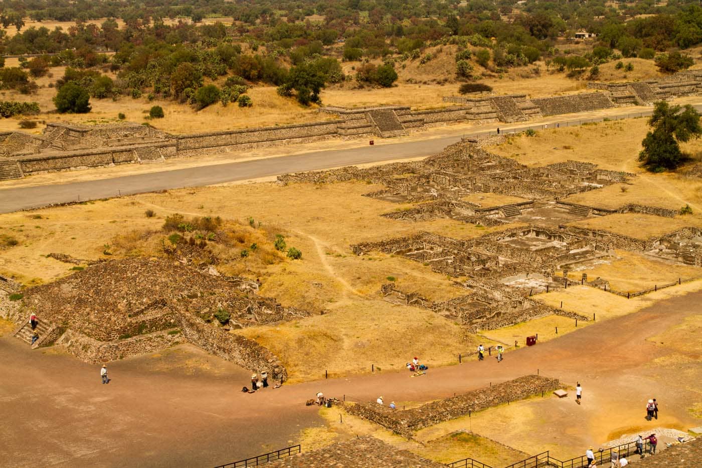
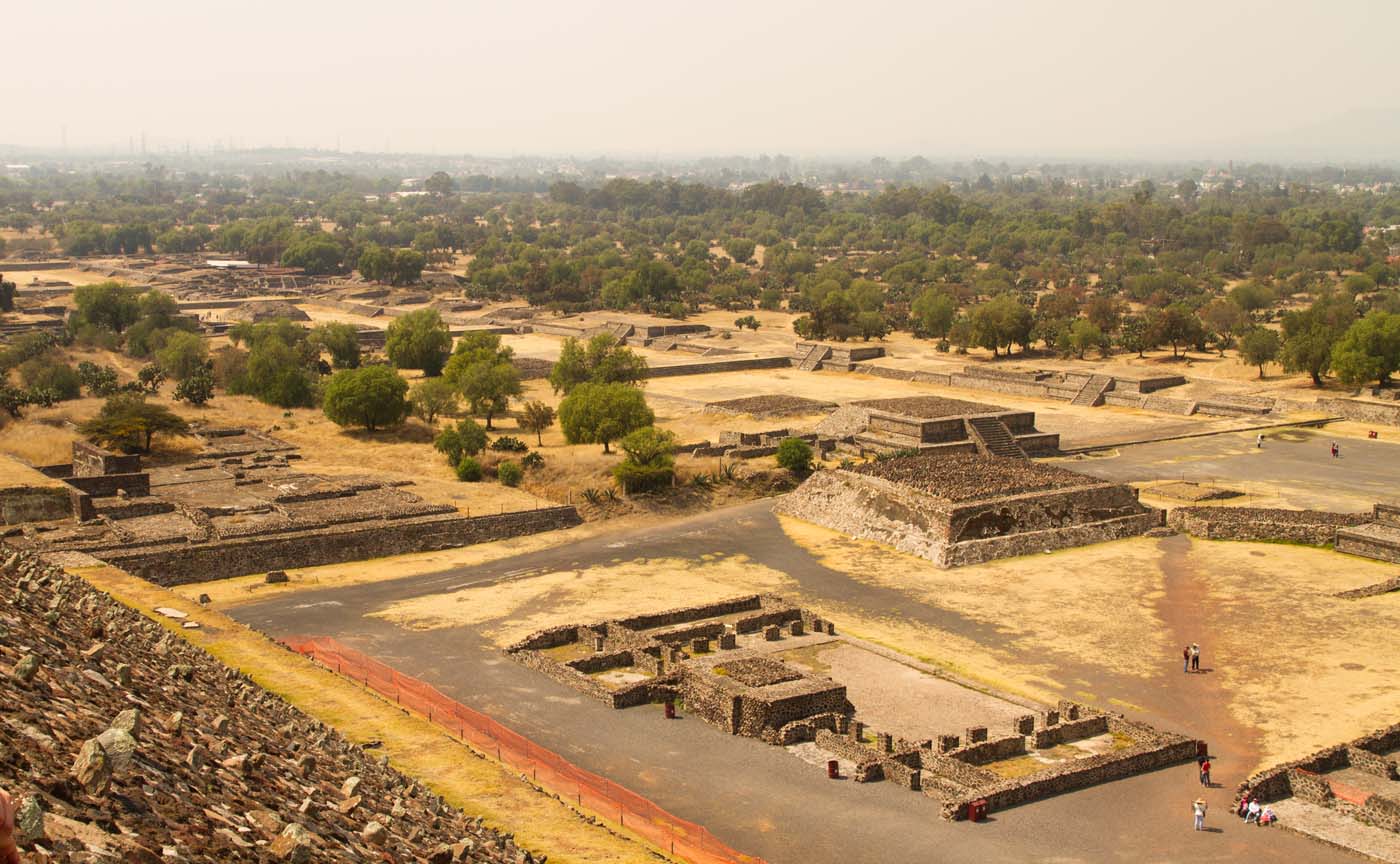
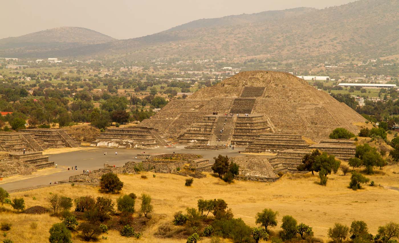
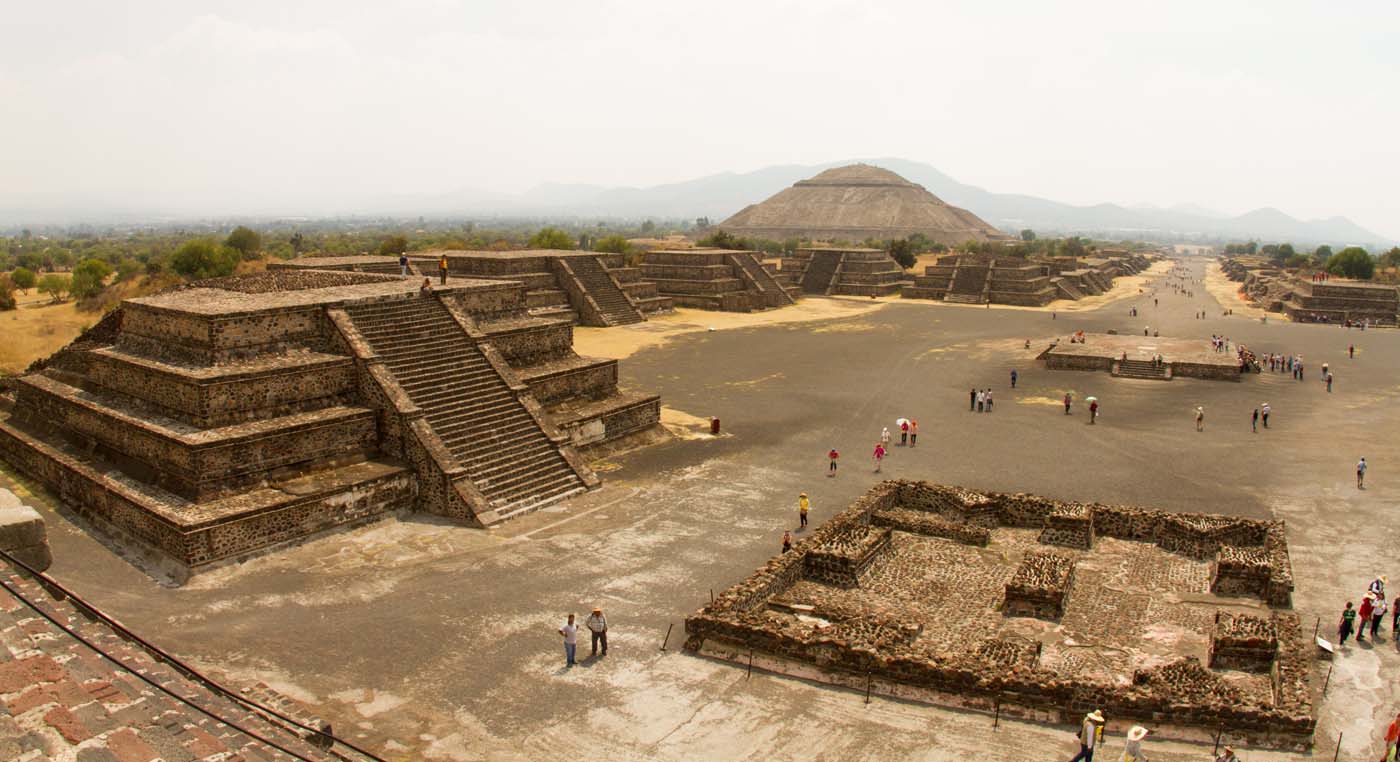
Teotihuacan is located in the Valley of Mexico close to Mexico City. It is famous for its Mesoamerican pyramids, but, as the largest city in the pre-Columbian Americas (about 125,000 or more) it gifts us with multi-family residential compounds, the Avenue of the Dead and its murals. Around 2,000 buildings remain on the city’s 57 square miles. The monumental area runs along the Calle de
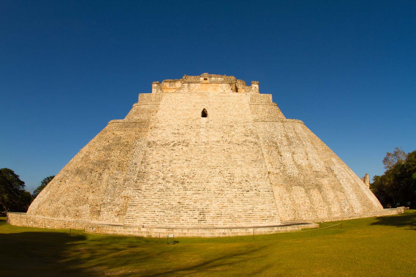
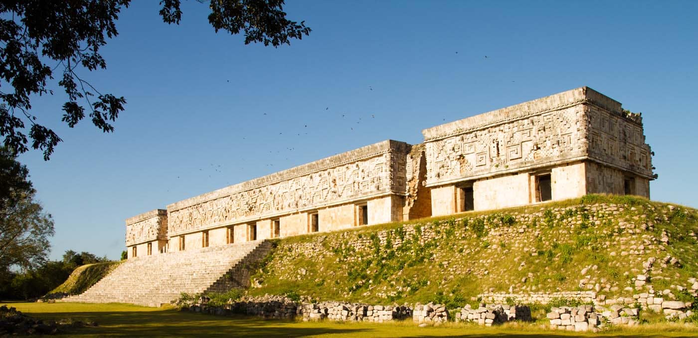
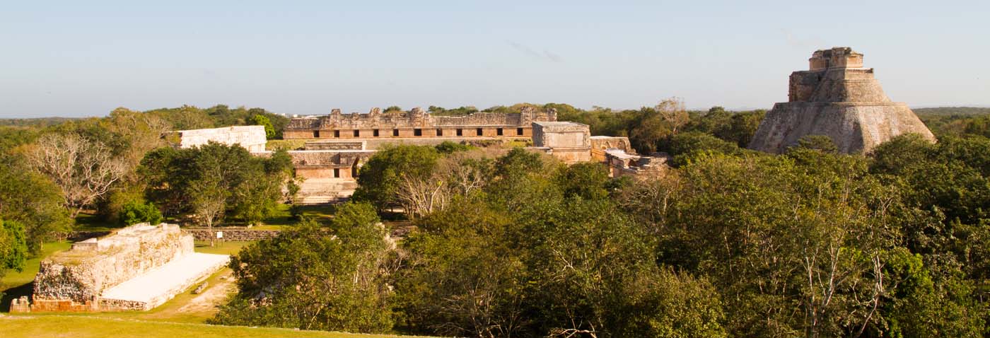
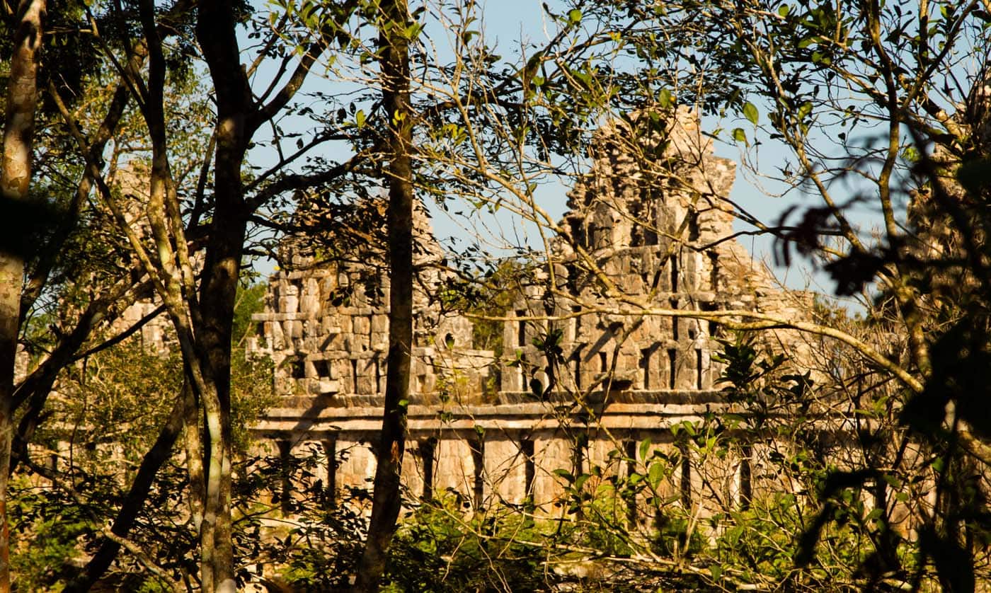
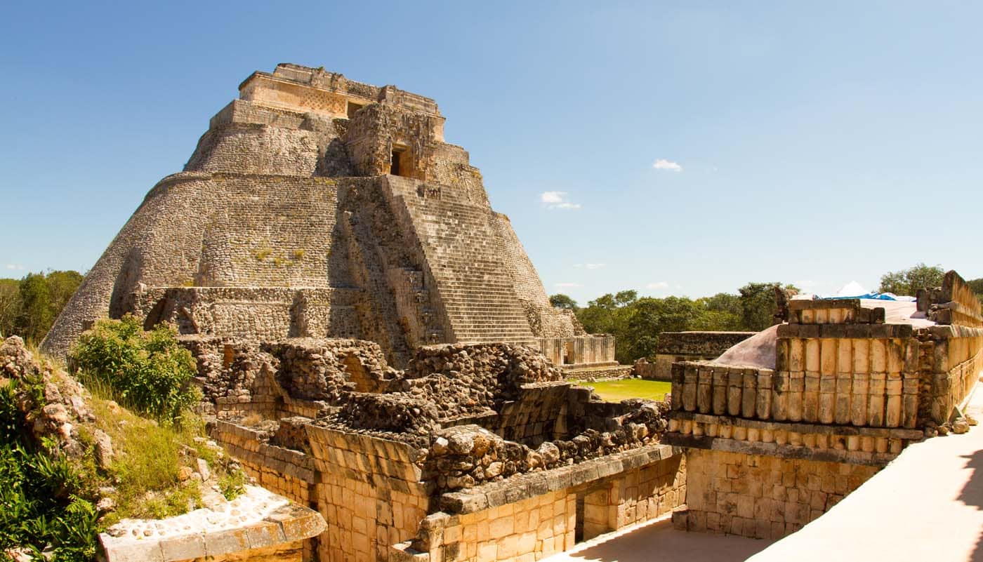
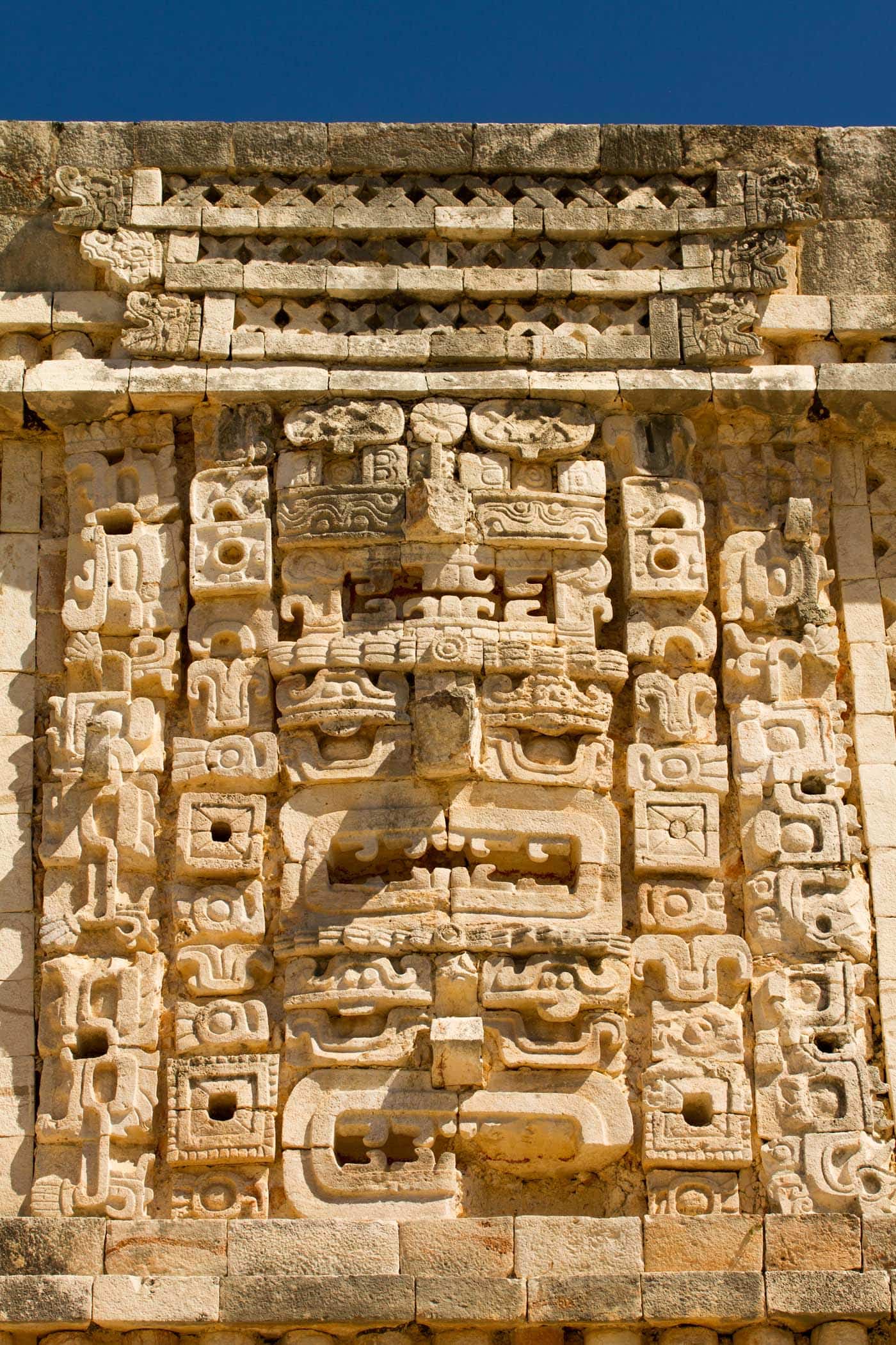
Uxmal is considered one of the most important archaeological sites of Maya culture, along with Palenque, Chichén, and Calakmul in Mexico, Tikal in Guatemala; indeed, it is considered one of the Mayan
Perù
Farming developed along the Pacific coast of Perù from around 6000 BCE. To channel and preserve the spring floodwater, dykes, ponds and canals had to be constructed. Later, farming specialized in crops like the potato and quinoa, and in herding llamas. This is the prologue to the rise of the Inca state, located originally around the present-day city of Cuzco. They expanded in all directions to cover an enormous area along the Pacific coast of South America.
One of the challenges thrown up by the administration of such a large state was that of keeping records. The Inca solved this by means of quipu, a system of knotted strings which could embody comparatively complex information. Although the surviving examples have not been deciphered, it is clear that this served as a form of writing and notation system.
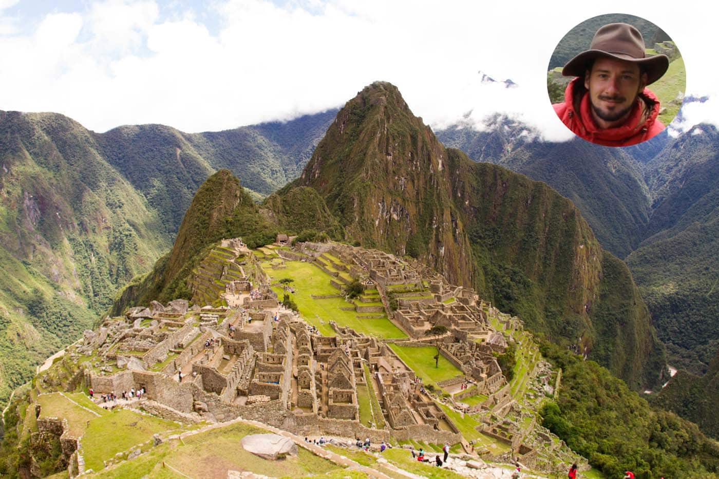
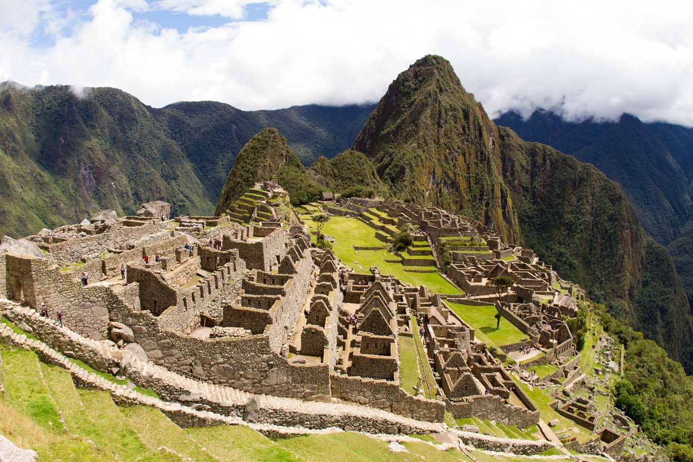
Macchu Picchu
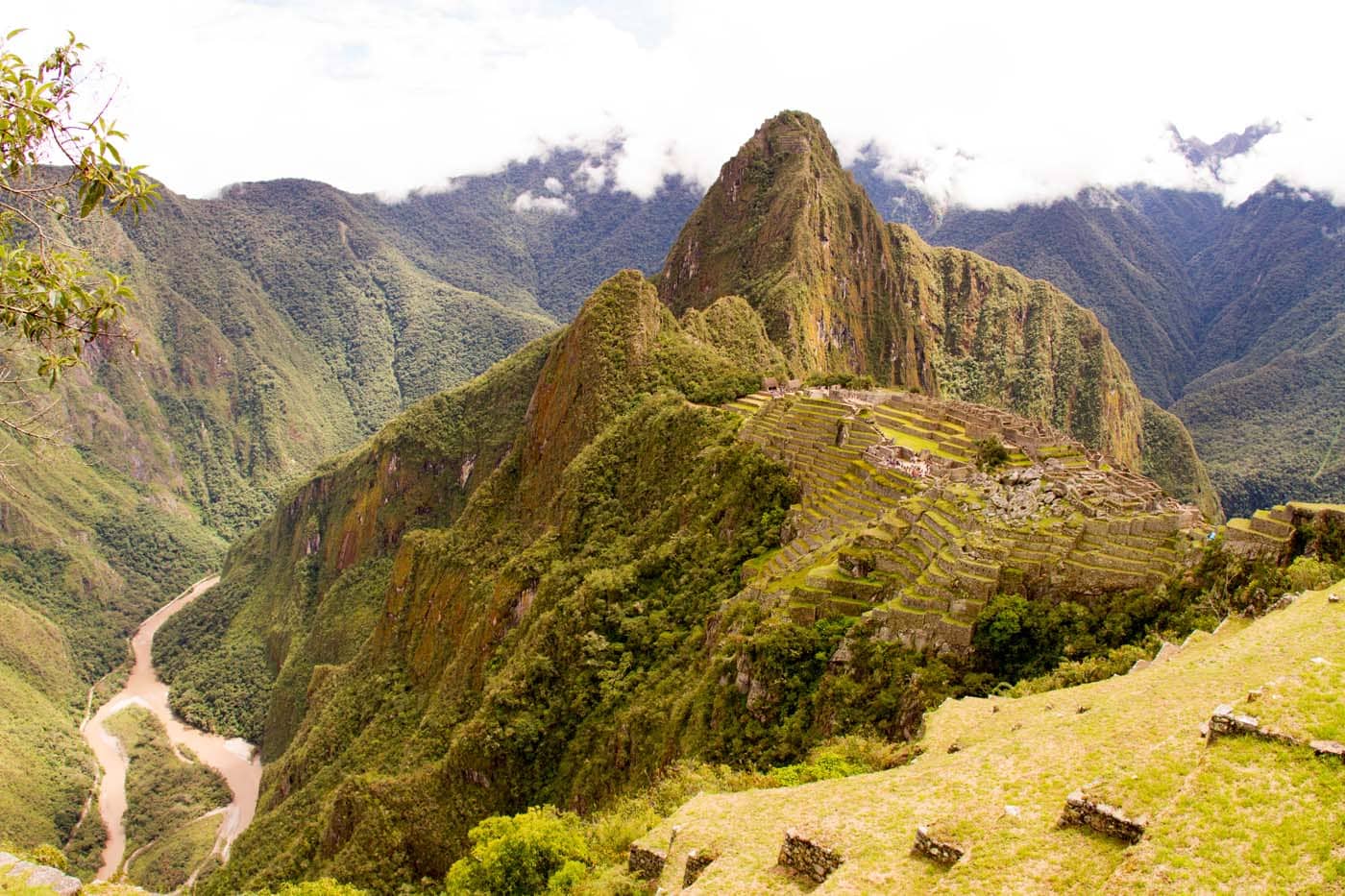
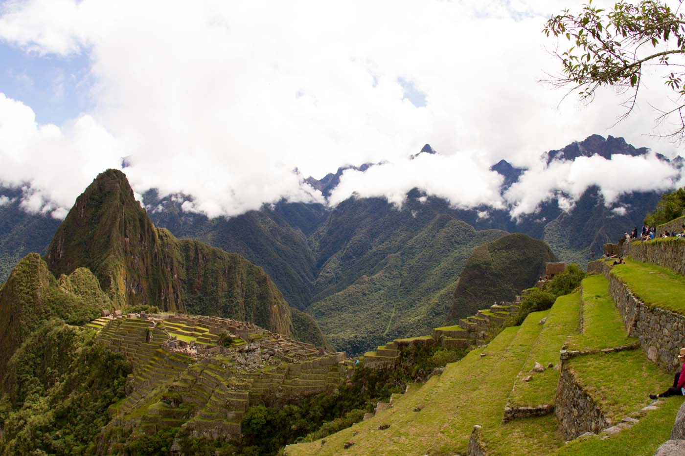
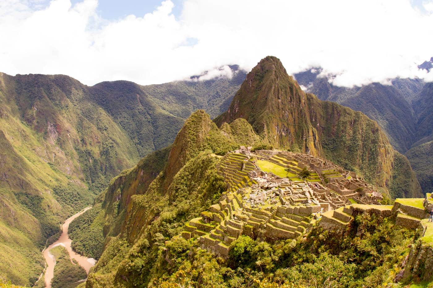
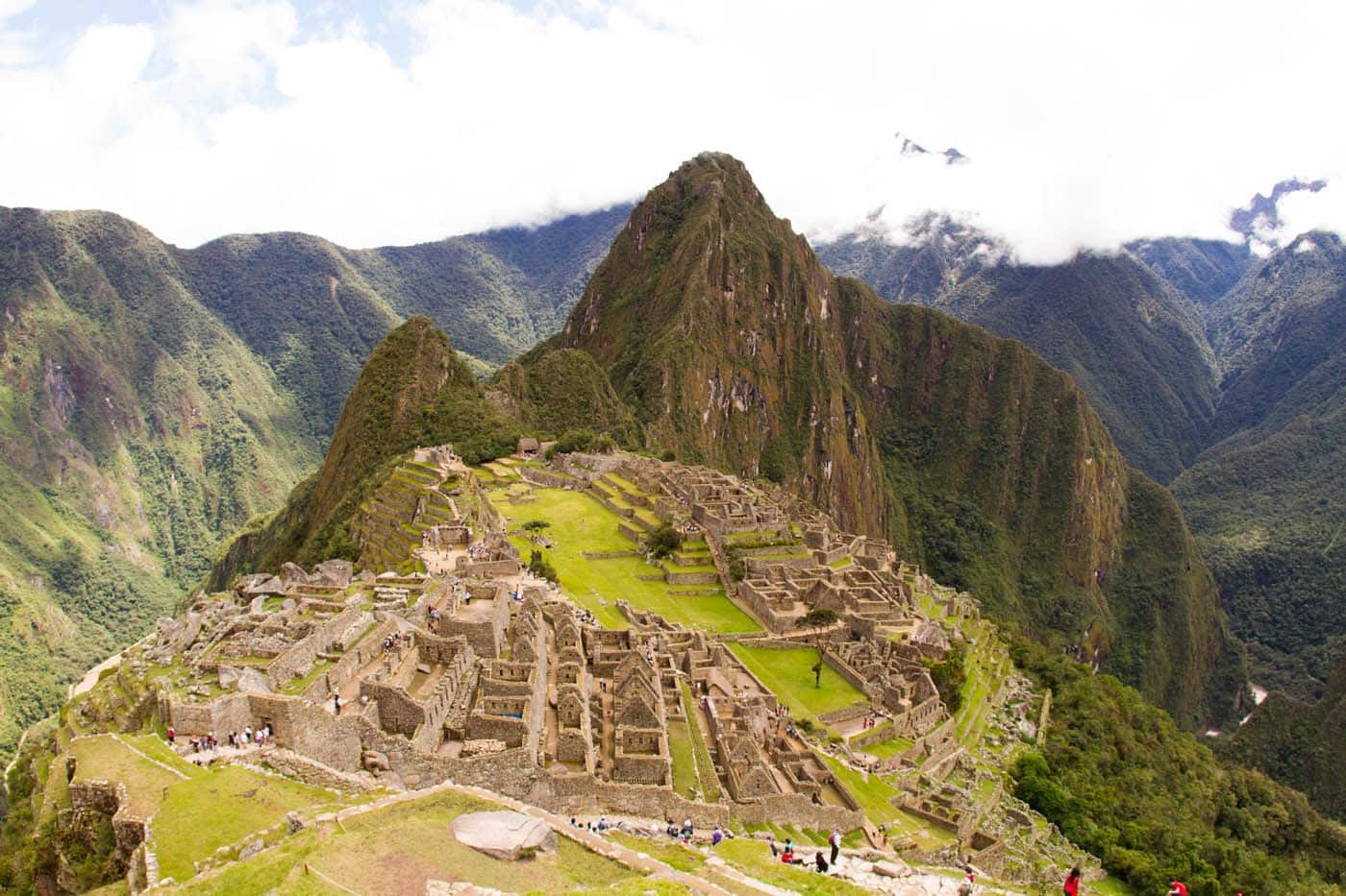
#Machu-Picchu, constructed between 1460 and 1470 under the leadership of the king Pachacuti Inca Yupanqui, was a ceremonial center inhabited by about 1,200 people. Of these, the majority were women who had been chosen to be vestals of the Sun god (as demonstrated by the discovery of 175 mummies, 80 percent of which were female).
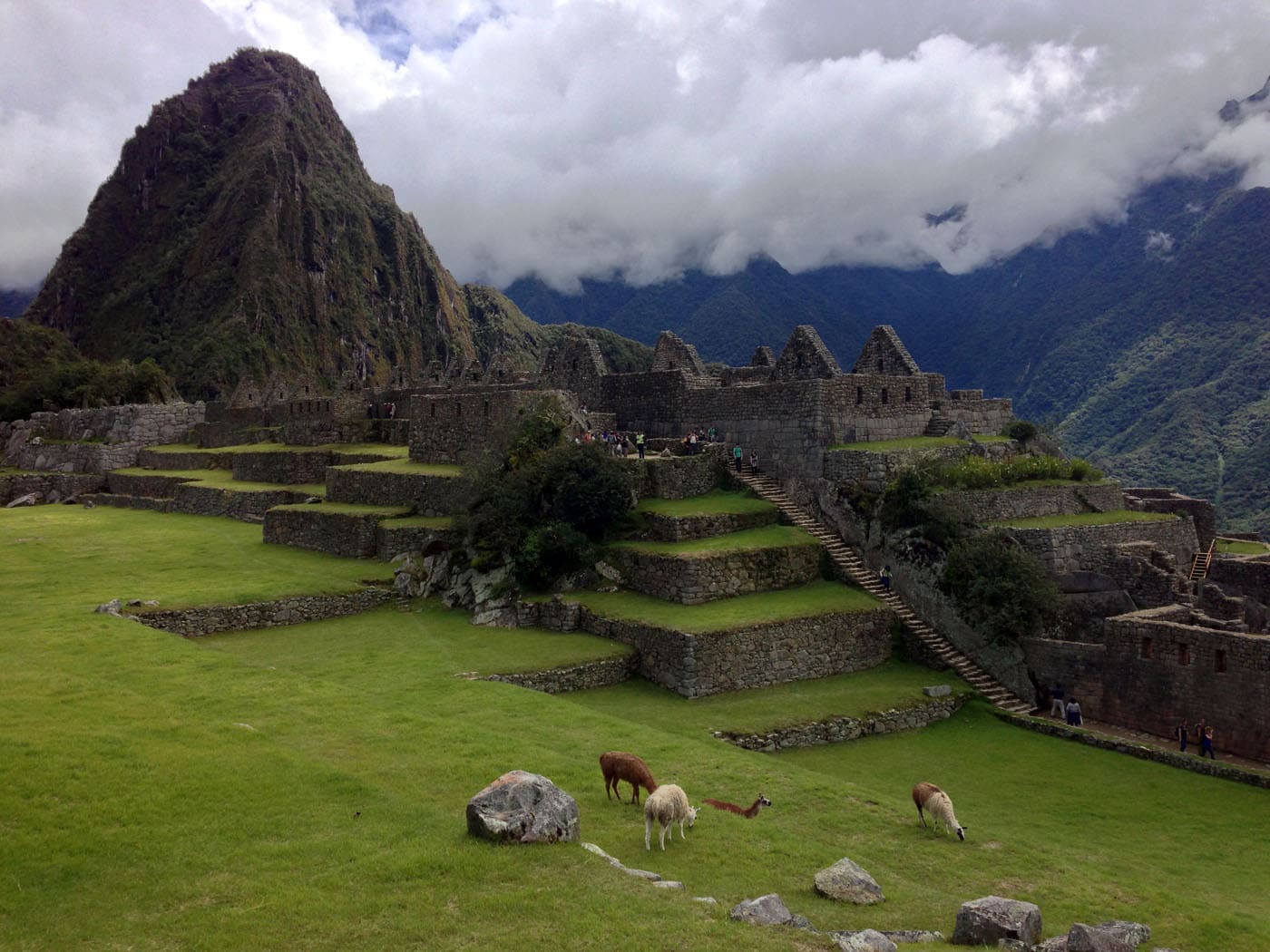
The remaining 20 percent were priests and children. The archaeological area consists of 200 buildings, most of which were either houses or warehouses, which were built on blocks of granite to “embrace” the rocks and exploit the morphology of the terrain.
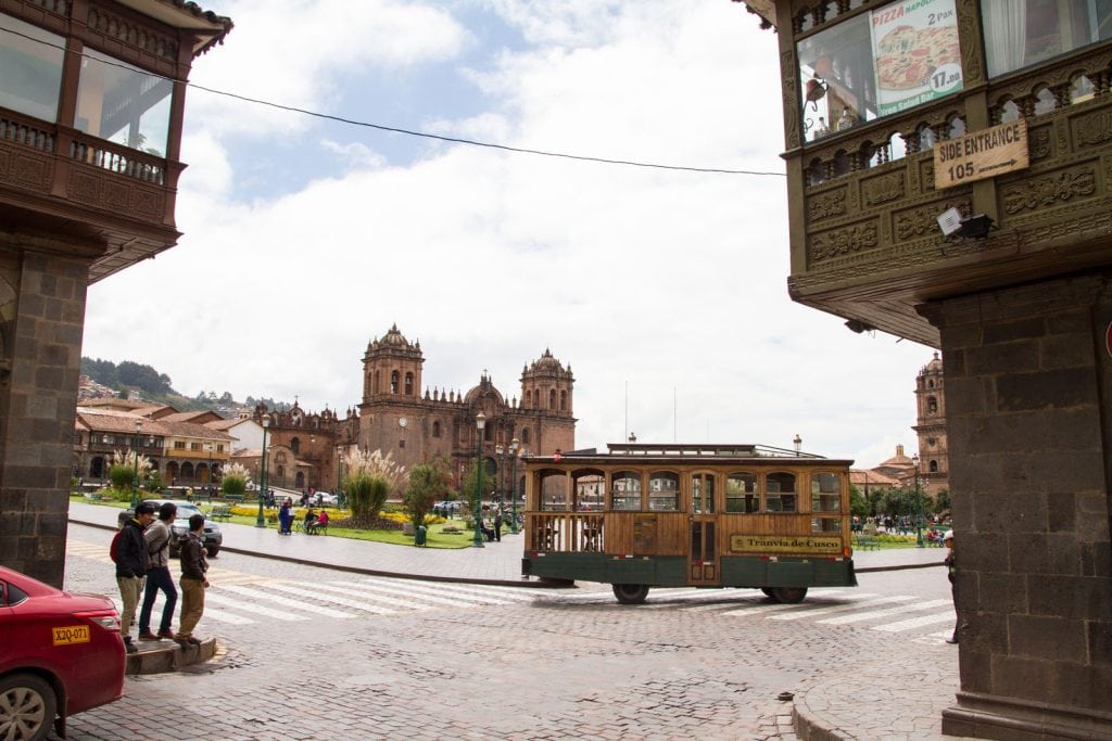
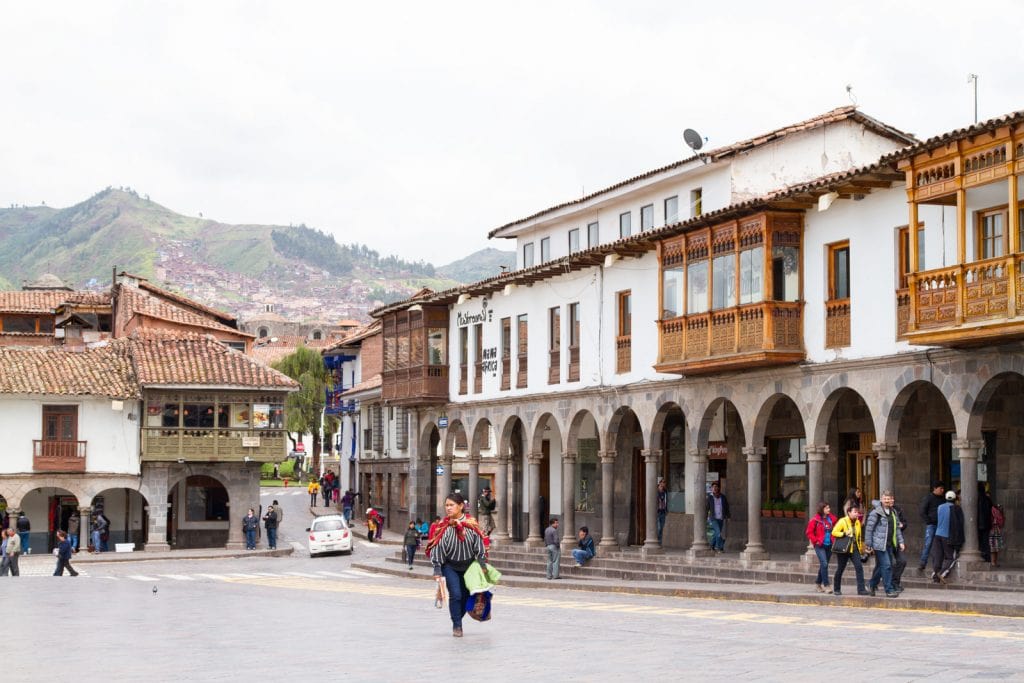
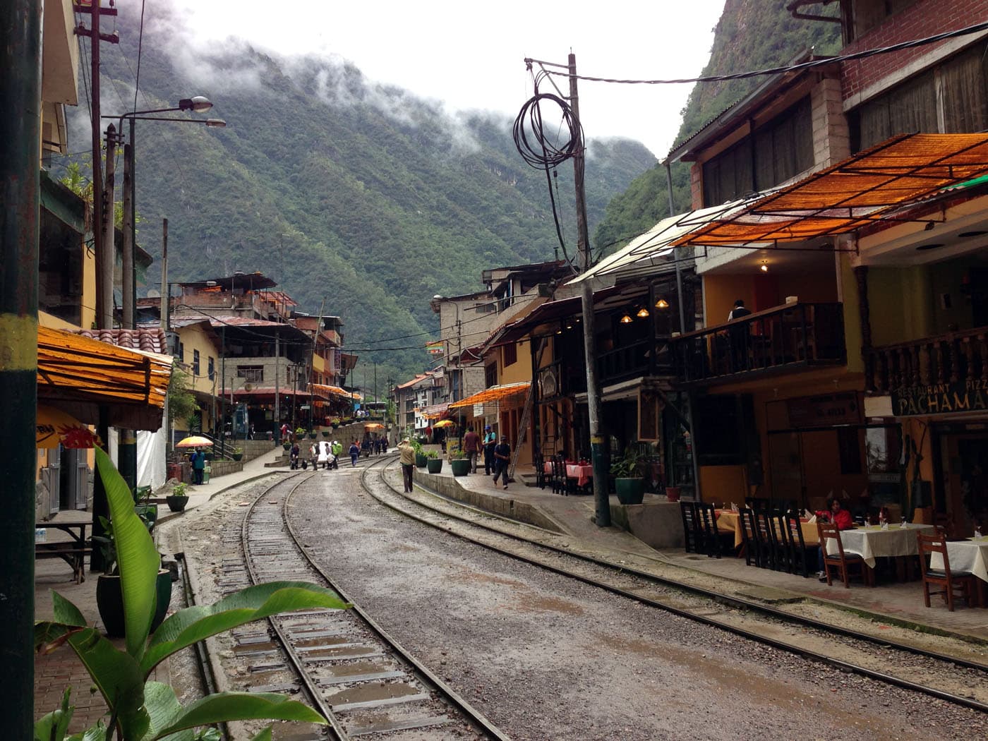
Cuzco and Aguas Calientes
When the Spaniards led by Pizarro arrived in Cuzco in 1532, they utterly destroyed the Inca Empire, but never learned of the existence of Machu Picchu. Five years earlier, an epidemic of bubonic plague had caused the death of 50 percent of the Inca population, and the sacred mountain had consequently been abandoned. For centuries, only the few inhabitants of the Urubamba Valley knew of the site’s existence, until July 24t, 1911, when the American archaeologist Hiram Bingham rediscovered it.
References.
Courtlandt Canby (1980). Archeology of the World. Chancellor Press, London.
Tickell (1991). Tikal, City of the Maya. Tauris Parke Books, London.
Wikipedia